Chapter 1 – The Spanish Period
The San Fernando Valley, in which the city of Burbank is located, has passed through many adventurous stages of development. Because several of these events left their imprint on the Burbank of today, it is fitting that they be reviewed as background for our story.
Juan
Rodriguez Cabrillo, sailing for the Spanish king, was the first to chart and to
name the coastal harbors and islands of California in 1542-1543. On September
28, 1542, Cabrillo landed at Point Loma in San Diego Bay. His discoveries and
map work gave Spain a claim to California, but it was not until more than two
hundred years later that colonial settlements were attempted. The picture shows
the Cabrillo National Monument at Point Loma.
Spanish
occupation of California actually was began in 1769 with the establishment of
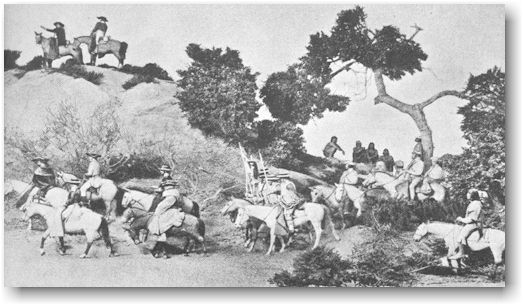
the mission at San Diego. As shown in the picture above, Don Gaspar de
Portola', governor of Baja California, led a party made up of mounted soldiers,
Indians, and a pack train of a hundred loaded mules and spare animals on a
coastal route with Monterey Bay as the objective. After leaving the area now
known as Los Angeles and Westwood, the group followed an Indian trail up
Sepulveda Canyon. This trail many years later became part of the San Diego
Freeway. At the crest of the canyon, members of the party saw a wide, flat
basin approximately twenty-five miles miles in length and ten miles wide – the
San Fernando Valley. Father Juan Crespi, an intimate associate of Franciscan
Friar Junipero Serra, wrote a description of the valley:
"We saw
a very pleasant and spacious valley. We descended to it and stopped close to
the watering place, which is a very large pool. We gave
to this plain the name of the Valley of Santa Catalina de Bononia de los
Encinos."

The large
pool can be seen today at the Los Encinos State Historical Monument on Ventura
Boulevard in Encino.
Twelve years
later, in 1781, Governor Don Felipe de Neve, Spanish Governor of California,
with a party of forty-six people made up of soldiers, priests, and eleven
families from Mexico with their twenty-two children, was sent to build a
settlement which was named El Pueblo Nuestra Senora la Reina de Los Angeles de
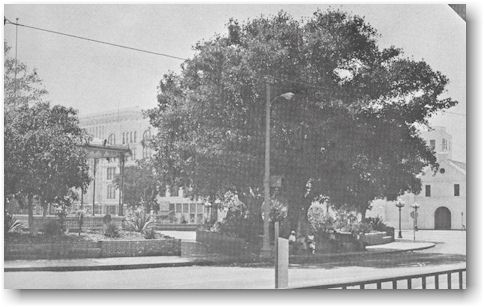
Porciuncula. The pueblo was built around a public "square" called a
plaza which was actually round in shape. All of the houses, the church, and
other buildings faced the plaza. Los Angeles became the first permanent pueblo
settlement in southern California. The original plaza with nearby Olvera Street
and the Old Mission Plaza Church may be seen today in the heart of the city of
Los Angeles.

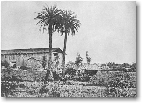
In 1797, San Fernando Mission was established midway between the San Gabriel Mission and that of San Buenaventura because it was too much to ask a Franciscan Friar to walk from one mission to the other without a stopping place in between. The name “San Fernando Rey” was given to the mission in honor of “glorious San Fernando, King of Spain.”
To encourage
people to settle in California, the Spanish government granted large tracts of
land called ranchos to the Spanish Dons. Burbank is located on parts of two of
these ranchos, San Rafael and La Providencia. Rancho San Rafael was granted to
Jose Maria Verdugo in 1798. It was probably the largest land grant ever given.
It included the areas known as Glendale, Garvanza (now Highland Park), Eagle
Rock, York Valley, Casa Verdugo, and much of Burbank. Although Verdugo probably
never knew how many acres his grant contained, it consisted of eight leagues of
land stretching roughly from the Arroyo Seco in present day Pasadena to the
Rancho Ex-Mission San Fernando - a total of 36,403.32 acres. Rancho La
Providencia was a Mexican land grant created after Mexico won her independence
from Spain in 1821. The grant consisted of 4,600 acres west of the Rancho San
Rafael which was given to Three people, Commandante J. Castro, Luis Arenas, and
Vincente de la Ossa.
In those
days, the Spanish Dons had no accurate way to measure land. It is said that
this was often done by using a reata or lasso rope, the kind used for catching
cattle, as a measuring instrument. This reata was made of rawhide, and
sometimes could be stretched. Each Don made his own reata as long as he wanted
it, depending on how big a loop he could make, and how far he could throw it.
Thus, the Don with the longest reata usually got the largest piece of land.

The two
ranchos, San Rafael and Providencia, can be located on the map, "The Old Spanish
and Mexican Ranchos of Los Angeles County."
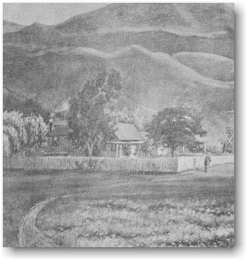
This painting shows the ranch house that stood on Rancho La Providencia near the present Barham Boulevard and Forest Lawn Drive.
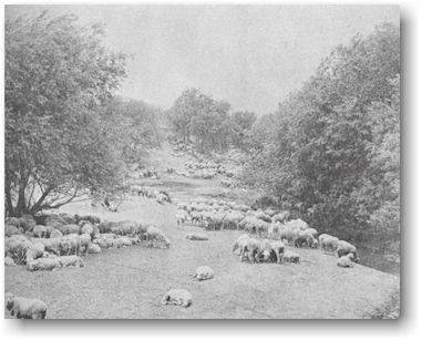
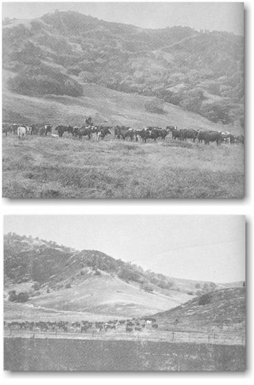
The Spanish government required the owners of
ranchos to stock part of their land grants, therefore, flocks of sheep and
herds of cattle grazed on many acres of the San Fernando Valley.
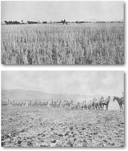
The owners
of the ranchos raised great quantities of grain such as wheat and barley. The
cultivation of part of their land was another requirement of the Spanish
government.
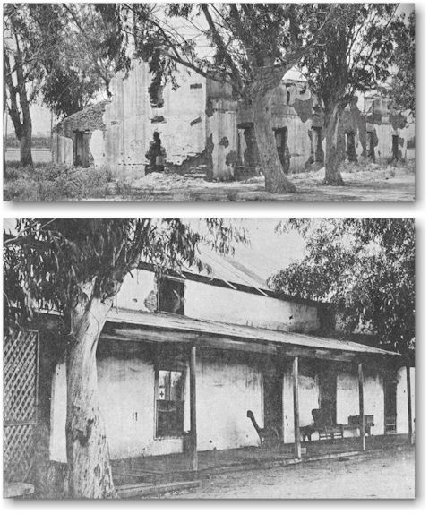
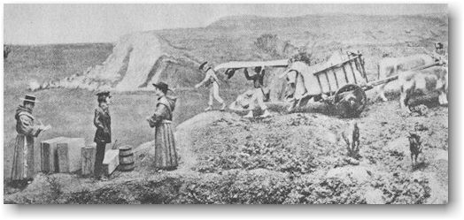
The home of
Andres Pico was one of the early ranch houses near the San Fernando Mission.
Andres Pico was the brother of the last Mexican governor of California, Pio
Pico. These pictures show the home before and after it was restored.
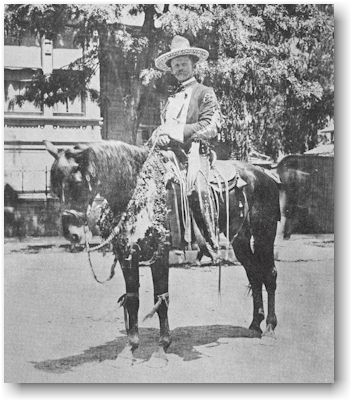
Fiestas were
popular with the Spanish settlers. They often held parades where proud horse
owners decorated their mounts with flowers and ribbons.
During the
time that Spain held California, American ships sailed around Cape Horn to the
California harbors to buy hides and other products raised either on the ranchos
or by the Indians living at the missions. The American sailors told alluring
accounts of the area when they returned to the East. Also during this time, the
United States government sent scouts overland to survey land routes to
California. By 1841, several parties of adventurous Americans were organized to
make the hazardous trip over the Rocky Mountains and, in November of that year,
a party of twenty-five Americans, suspected by the Mexicans of being political
meddlers, arrived in San Gabriel. Within four years, however, the attitude of
suspicion had vanished and the two leaders of the party were granted a tract of
48,000 acres known as La Puente Rancho. Further immigration to California was
stimulated when, in 1844, the United States government sent John C. Fremont and
his party to the far west on his second expedition of scientific research.
In 1845, the
Battle of Providencia unseated the tyrannical Mexican governor, Manuel
Micheltorena, and replaced him with Pio Pico. Micheltorena's Mexican forces had
three cannons and the Californians under Pico had two. The two forces came
within long cannon range of each other near Cahuenga Pass, February 20, 1845.
They kept their cannons far enough apart to make sure no one would be injured.
Heavy cannonading from these batteries continued throughout the afternoon, but
as both armies kept in close shelter under the banks of the Los Angeles River,
little damage was done. According to one account of the battle, "a Mexican
horse's head was shot off and a California mule was injured by flying
debris." The next day the battle resumed on the La Providencia Rancho. But
still both armies were reluctant to fight. After two hours of cannonading from
both sides without visible results, Governor Micheltorena raised the flag of surrender.
Most of his men had deserted in favor of Pio Pico. For many years, Burbank
residents in the vicinity of Warner Brothers Studio dug up cannon balls from
time to time. La Providencia was a proud, slightly battle-scarred old rancho.
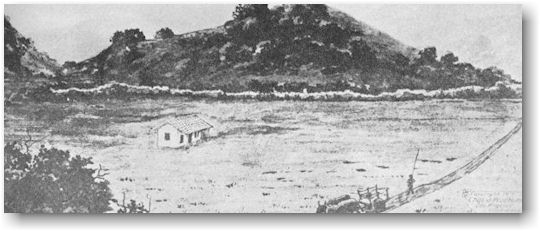
Rancho Cahuenga, near the location of the present Hollywood Bowl, as it appeared in January, 1847, at the signing of the Treaty of Cahuenga.
The Spanish
period ended in 1847, when the Treaty of Cahuenga, also known as the Cahuenga
Capitulation, concluded the California phase of the war between Mexico and the
United States. General Andres Pico and General John C. Fremont signed the
treaty for Mexico and the United States. California became a possession of the
United States in 1848 when the Treaty of Guadalupe Hidalgo was signed in
Mexico.
Prior to
this time, in 1812, Russia had established a successful settlement at Fort Ross
located just north of San Francisco. In 1822, the Russian Czar had issued a
proclamation excluding all other nations from commerce and fishing in the north
Pacific coastal waters. But, when President James Monroe proclaimed the famous
Monroe Doctrine in 1823, California was saved from further colonization by the
Russians. The American President's message together with the fact that Fort
Ross had been a heavy financial burden had discouraged the Russians from
expanding their holdings. Captain Johann Augustus Sutter of Sacramento
purchased Fort Ross in 1841 when the Russians decided to dispose of both the
property and the equipment. They finally withdrew from California in 1842.